
If you feel like there have been a lot of severe thunderstorm watches issued by Environment Canada this summer, you’re not alone.
It seems like they’ve been a daily occurrence at times, especially over the latter half of July and into early August when NowMedia published nine Okanagan thunderstorm watch stories in an 18-day span.
There were also other days where no weather alert was issued, but there was still a “risk of thunderstorms” in the forecast.
And while Brian Proctor doesn’t have the exact numbers compared to previous years, anecdotally he feels the same way.
“We have seen more this year than we have in the past number of summers,” the Environment Canada meteorologist told NowMedia.
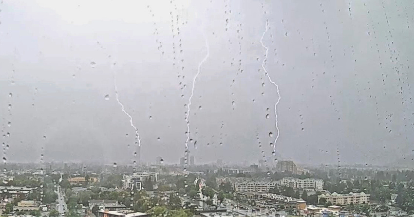
.JPG)
But why is it happening? And can it be attributed to bigger climate patterns, much like La Niña has produced cooler, wetter BC winters in recent years?
The short answer to that last question is no, but Proctor did provide an explanation into the reason why the Okanagan has experienced atypical summer weather this year.
“It’s largely due to what's happening in the atmosphere loft compared to what we've seen over previous years,” he noted.
Most summers, a big upper ridge locks in over southern BC during the summer months and produces the really hot and dry extended periods that we’re so used to.
That hasn’t been the case this year, however, and Proctor says we’ve seen a much more “transitory pattern of ridges and troughs moving across.”
A trough is an elongated area of relatively low atmospheric pressure, which comes with more unsettled conditions that are typically associated with thunderstorm development.
Not only is this transitory pattern why there have been so many days with potential thunderstorms, it’s also why we haven’t seen many extended summer heat waves.
According to Proctor, those long periods of sunny days in the mid-to-upper 30s, or even pushing 40°C, simply don’t happen without an upper ridge locking in over the region.
And while there have been many severe thunderstorm watches, it certainly hasn’t resulted in a countless number of summer storms in the Okanagan. In fact, there have only been a small handful.
That’s just the nature of thunderstorms watches, Proctor explains, as they only act as a heads up to notify the public that things are “potentially in place” to produce stormy weather.
In fact, it’s in the verbiage of every thunderstorm watch, which only indicate that “conditions are favourable for the development of severe thunderstorms.”
As Proctor puts it, “the ingredients are there,” but it’s not saying those ingredients will come together at the right place and time to produce a lightning show.
He adds that another complication factor in the BC Interior is that thunderstorms often form over ridgelines, not at valley bottoms.
During many of these thunderstorm watches, Okanagan residents can see the stormy weather pass by them up in the hills, while the weather remains relatively pleasant in the city.
"So we see the conditions are potentially there to produce some of these storms, but we don't necessarily always see them forming over valley bottom communities,” noted Proctor.
It’s hard to predict the weather around these parts – you know the saying, “if you don’t like the weather in the Okanagan, just wait an hour – but the forecast looks a little different moving forward.
“When we look at our monthly forecast, it's suggesting in general we're going to see temperatures across the southern Interior above normal,” Proctor said.
“So I think we're probably trending to drier and warmer conditions as we move through towards the middle and end of August at this point in time.”
Despite that prediction, Proctor notes that it hasn’t been the kind of year where we see a locked-in upper ridge, so don’t expect sweltering heat in the final few weeks of the summer.
“I would be somewhat surprised if we're going to see a tremendous amount of heat. I really don't think we'll necessarily see a heat wave or a heat dome coming in, or anything of that nature.”


