
(UPDATE: June 22 @ 10:55 am) - The size estimate for the Saw Creek wildfire near Lytton remains just over 700 hectares.
There was no recorded growth by the BC Wildfire Service (BCWS) over the past 24 hours, although it's unclear whether that reflects what's happening with the fire or simply a lack of updated mapping.
The BCWS says cooler overnight temperatures once again were positive for the fire fight, but high daytime temperatures and lower humidity in today's forecast could increase fire activity.
"Light northeast winds are expected today with increased gusts in the afternoon," the latest BCWS update notes.
Structure protection continues to be a big priority for those battling the fire and crews are using direct attack methods to work on the north and south flanks.
"Along the north flank, crews are establishing a 50-foot control line along the Lytton drainage working upslope," the update says.
"Danger trees assessments and falling are being completed along the highway corridor while also establishing a 100-foot control line long between the Hwy 1 to the Fraser River."
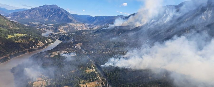
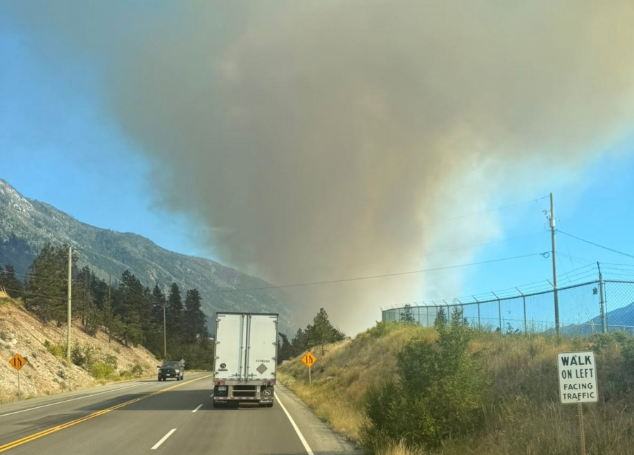
Hwy 1 remains closed between Boston Bar and just south of Cache Creek, as it has been since the fire broke out on Friday.
The BCWS has an incident management team on this fire along with 150 ground personnel, 53 structure protection personnel, 10 helicopters and five pieces of heavy equipment.
(UPDATE: June 21 @ 12:30 pm) - The Saw Creek wildfire near Lytton showed much slower growth on Sunday.
The latest size estimate for the fire is 703 hectares, up just over 100 hectares from Saturday.
Fire activity was decreased overnight due to cooler temperatures and light winds," noted the BC Wildfire Service's Sunday morning update. "Crews and structure protection personnel prioritized the protection and defense of structure in the fire area."
The BCWS says the fire is currently burning between ranks one and three, but there's the potential for fire activity to increase on Sunday as the temperatures hit 30°C.
The Trans-Canada Highway (Hwy 1) remains shut down between Boston Bar and just south of Cache Creek. There's no indication about when the highway could reopen.
(UPDATE: June 20 @ 8:30 pm) - The Saw Creek wildfire grew significantly on Saturday.
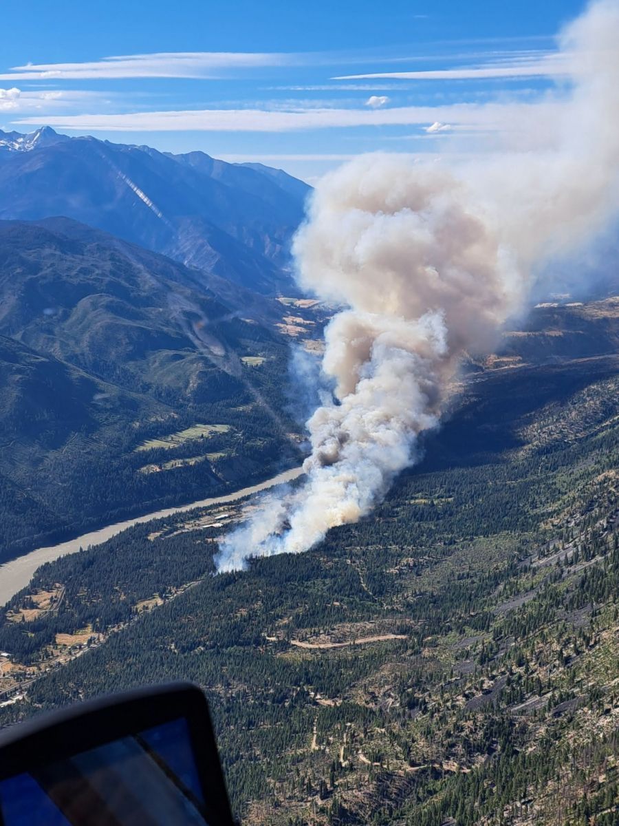
The blaze that sparked just south of Lytton on Friday is now an estimated 600 hectares as it burns on both sides of the Trans-Canada Highway (Hwy 1) on the east side of the Fraser River.
Hwy 1 remains closed after being shut down due to the fire on Friday.
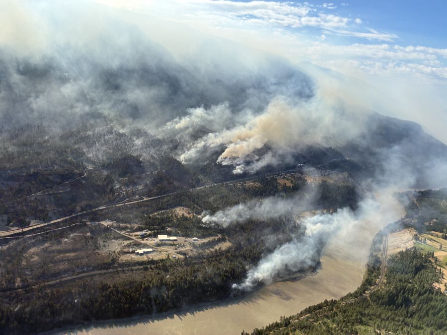
The Thompson-Nicola Regional District (TNRD), Village of Lytton and Lytton First Nation (LFN) all have evacuation orders in place. Evacuation alerts have been issued by the TNRD, LFN, Siska Indian Band and Skuppah Indian Band.
While the fire was burning aggressively at rank four and five on Friday, the BC Wildfire Service says it's been burning rank two and three on Saturday.
The latest BCWS update says temperatures were cooler today, but hot and dry conditions have made fuels in the area "highly-susceptible to ignition."
"Overnight, crews and structure protection personnel will prioritize the protection and defense of structure in the fire area," the BCWS explains.
"Fire crews and aircraft continue to focus efforts on securing the perimeter of the communities near this incident."
There are currently 130 BCWS ground personnel, nine helicopters, structure protection crews and an incident management team assigned to the Saw Creek wildfire.
(UPDATE: June 19 @ 10:15 pm) - The Saw Creek wildfire just south of Lytton is now an estimated 200 hectares in size.
The Thompson-Nicola Regional District (TNRD) has declared a state of local emergency for Electoral Area "I" (Blue Sky Country) and issued an evacuation order for 13 properties.east of the Trans-Canada Highway (Hwy 1).
The affected addresses are east of the Trans-Canada Highway (Hwy 1) between Florence Road north and Airport Road, with a map of the affected area available here.
"If you are in the described area, you must leave immediately," says a TNRD statement.
In addition, the Village of Lytton has issued an evacuation alert for the entire community due to the wildfire threat.
Hwy 1 remains closed through the area at this time and DriveBC isn't expecting another update until after midnight. Travellers are being told to detour via the Coquihalla (Hwy 5) and Hwy 97C.
(Original story: June 19 @ 8 pm) - A suspected human-caused wildfire is burning around three kilometres south of Lytton.
The Saw Creek wildfire was first discovered Friday and has quickly grown to 100 hectares in size as of 8 pm.
It has resulted in the closure of the Trans-Canada Highway (Hwy 1) between Ashcroft and Boston Bar.
According to the BC Wildfire Service, the fire is burning rank 4 and 5.
That means a highly-to-extremely vigorous surface fire with an organized crown fire, as well as moderate-to-long range spotting.
“Hot and dry conditions have made fuels highly susceptible to ignition,” a BCWS update explained.
The BCWS is currently battling the blaze with an unspecified number of ground personnel and aviation resources.
It has quickly become a 'wildfire of note' on the BCWS map.
NowMedia will update this story as more information becomes available.


