
Advisory, watch and warning have been usurped by yellow, orange and red.
It's Environment Canada's new colour-coded weather alert system that's apparently more direct and easier to understand.
"The colours have high glance value," Environment Canada meteorologist Bobby Sekhon told NowMedia Group.
And as colours go, yellow indicates 'take notice', orange is darker and more severe and red is darker still and the universal colour of danger, the most urgent and critical.
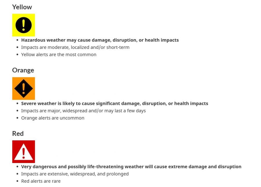
"The colours tell you what the weather will be and what it will do," said Sekhon.
"It's a risk-based warning system that's being used around the world. The UK, France, New Zealand and South Africa are all using it."
In order of seriousness, least to most, the colours are:
1. Yellow -- hazardous and somewhat equivalent to the old weather advisory or statement.
As the least serious of the alerts or warnings, it's the one you'll see issued most often.
2. Orange -- severe and kind of like the weather watches of old.
3. Red -- very dangerous and possibly life-threatening akin to the previous weather warnings.
In the short time since Environment Canada introduced the yellow, orange and red system, colour warnings have been thrown at us right, left and centre.
A couple of weeks ago, Environment Canada issued a yellow snowfall warning for Kelowna that never materialized.
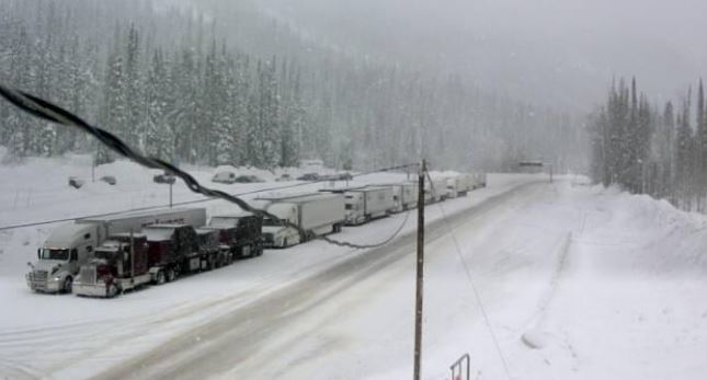
Earlier this week, orange atmospheric river warnings were issued for the South Coast, Fraser Valley and further inland.
Those did materialize and resulted in the heavy rains the caused localized flood and swirled debris around forcing temporary closures at points along Highways 1 (Trans-Canada), 3 (Crowsnest, Hope-Princeton), 5 (Coquihalla), 7 (Lougheed), 11 (Abbotsford-Mission) and 99 (Sea-to-Sky).
.JPG)
On Friday, Environment Canada issued a yellow snowfall warning for the stretch of the Trans-Canada running from Sicamous to Golden, particularly for the patch from the Eagle Pass to the Rogers Pass that was forecasted to dump 15 centimetres of the white stuff, and reduce visibility.
In the month the colour-coded system has been in use, Environment Canada has not issued a red (most serious, very dangerous) warning in BC.
"Red warnings will be very rare," said Sekhon.
"Red would be reserved for the most extreme weather events this province has ever seen, like the 2021 atmospheric river (that caused catastrophic flooding in the Fraser Valley and washed out sections of the Coquihalla highway that led to months closures) and the 2021 heat dome (that saw temperatures soar to 47C)."
.jpg)
While we're talking weather, you might see Environment Canada use the term 'wintery mix' more often for the Southern Interior this season.
The government agency forecaster likes to be as specific as possible and predicts, by name, rain, freezing rain, sleet, wet snow, hail, ice pellets, snow and heavy snow.
"But, if there could be different types of precipitation at this time of year, we could use 'wintery mix'," said Sekhon.
"Forecasting for the BC Interior is challenging because different areas could get different types of precipitation and 'wintery mix' could be part of the message. However, it's not really part of our vocabulary right now."
We've also all heard terms, usually that the media has made up to make weather sound more dramatic, dangerous or exciting, such as flash freeze, polar vortex, snowmageddon, Frankenstorm, superstorm and snowpocalypse.
Sometimes Environment Canada will use such informal slang, but prefers to stick to formal terms.


